Category:Maps of Ukraine
Jump to navigation
Jump to search
Countries of Europe: Albania · Andorra · Armenia‡ · Austria · Azerbaijan‡ · Belarus · Belgium · Bosnia and Herzegovina · Bulgaria · Croatia · Cyprus‡ · Czech Republic · Denmark · Estonia · Finland · France‡ · Georgia‡ · Germany · Greece · Hungary · Iceland · Republic of Ireland · Italy · Kazakhstan‡ · Latvia · Liechtenstein · Lithuania · Luxembourg · Malta · Moldova · Monaco · Montenegro · Netherlands‡ · North Macedonia · Norway · Poland · Portugal‡ · Romania · Russia‡ · San Marino · Serbia · Slovakia · Slovenia · Spain‡ · Sweden · Switzerland · Turkey‡ · Ukraine · United Kingdom · Vatican City
Specific status: Akrotiri and Dhekelia‡ · Faroe Islands · Gibraltar · Bailiwick of Guernsey · Isle of Man · Jersey · Svalbard – Limited recognition: Abkhazia‡ · Gagauzia · Kosovo · South Ossetia‡ · Transnistria · Northern Cyprus‡ · United Nations Buffer Zone in Cyprus‡
‡: partly located in Europe
Specific status: Akrotiri and Dhekelia‡ · Faroe Islands · Gibraltar · Bailiwick of Guernsey · Isle of Man · Jersey · Svalbard – Limited recognition: Abkhazia‡ · Gagauzia · Kosovo · South Ossetia‡ · Transnistria · Northern Cyprus‡ · United Nations Buffer Zone in Cyprus‡
‡: partly located in Europe
Use the appropriate category for maps showing all or a large part of Ukraine. See subcategories for smaller areas:
| If the map shows | Category to use |
|---|---|
| Ukraine on a recently created map | Category:Maps of the Ukraine or its subcategories |
| Ukraine on a map created more than 70 years ago | Category:Old maps of Ukraine or its subcategories |
| the history of Ukraine on a recently created map | Category:Maps of the history of Ukraine or its subcategories |
| the history of Ukraine on a map created more than 70 years ago | Category:Old maps of the history of Ukraine or its subcategories |
- See also maps needing categories in Category:Unidentified maps
- See also w:uk:Категорія:Зображення:Карти України (The Maps of Ukraine category from the Ukrainian Wikipedia)
Internationalization
Esperanto: Mapoj de Ukrainio
Русский: Карты Украины
Українська: Карти України
中文(简体):乌克兰地图
| Page index: | * A B C D E F G H I J K L M N O P Q R S T U V W X Y Z | |
| File index: | * A B C D E F G H I J K L M N O P Q R S T U V W X Y Z |
| Upload media | |||||
| Instance of | |||||
|---|---|---|---|---|---|
| Location |
| ||||
| |||||
Subcategories
This category has the following 46 subcategories, out of 46 total.
- General maps of Ukraine (1 F)
!
*
- Animated maps of Ukraine (4 F)
- Maps of Wikipedia in Ukraine (9 F)
- Photographs of maps of Ukraine (13 F)
A
- Agricultural maps of Ukraine (17 F)
C
D
E
- ECHO Daily Maps of Ukraine (36 F)
F
- Forestry maps of Ukraine (1 F)
G
- Geological maps of Ukraine (21 F)
H
L
M
N
O
P
R
S
T
U
- Unidentified maps of Ukraine (2 F)
W
Pages in category "Maps of Ukraine"
The following 2 pages are in this category, out of 2 total.
Media in category "Maps of Ukraine"
The following 58 files are in this category, out of 58 total.
-
1778 krym.png 1,921 × 1,080; 372 KB
-
Bilhorod-Dnistrovskyi Raion Map.tif 1,280 × 1,652; 732 KB
-
Bolhrad Raion Map 2020.tif 1,280 × 1,652; 734 KB
-
Donetsk PR Map.png 1,200 × 879; 358 KB
-
Eastern Okraina mp.png 941 × 721; 38 KB
-
Embassy Blood Drive, June 2, 2023 - 53029433798.jpg 7,086 × 4,501; 3.83 MB
-
Izmayil Raion Map 2020 July.tif 1,280 × 1,652; 725 KB
-
Kievan Rus Kievan Ruthenia.jpg 393 × 324; 31 KB
-
Map of Ukraine political Chemical indystry.png 800 × 559; 120 KB
-
Map of Ukraine. Easter eggs.jpg 5,472 × 3,648; 5.56 MB
-
Map of West Ukrainian.jpg 2,048 × 1,536; 249 KB
-
Mapa haradoŭ Ŭkrainy.png 2,560 × 1,720; 1.17 MB
-
Modern Ukraine in “Greater Ukraine”.jpg 1,170 × 718; 1.34 MB
-
Odessa Oblast Raion Map since July 2020.tif 1,280 × 1,652; 725 KB
-
Odessa Raion Map 2020 July.tif 1,280 × 1,652; 729 KB
-
Ostriv Velykyi Potomkin (5 June 2023).png 1,280 × 836; 381 KB
-
Plastvukraini.png 555 × 320; 36 KB
-
Podilsk Raion Map 2020 July.tif 1,280 × 1,652; 724 KB
-
Razdilna Raion Map.tif 1,280 × 1,652; 728 KB
-
Secretary Blinken Meets With Ukrainian Foreign Minister Kuleba in Kyiv (51830997305).jpg 5,299 × 3,533; 8.73 MB
-
Sketch-marshrut1.png 800 × 800; 823 KB
-
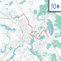
Sketch-marshrut10a.png 800 × 800; 838 KB
-
Sketch-marshrut12.png 800 × 800; 797 KB
-
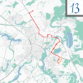
Sketch-marshrut13.png 800 × 800; 840 KB
-
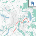
Sketch-marshrut14.png 800 × 800; 835 KB
-
Sketch-marshrut15.png 800 × 800; 836 KB
-
Sketch-marshrut15a.png 800 × 800; 836 KB
-
Sketch-marshrut16.png 800 × 800; 838 KB
-
Sketch-marshrut17.png 800 × 800; 795 KB
-
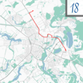
Sketch-marshrut18.png 800 × 800; 839 KB
-
Sketch-marshrut2.png 800 × 800; 822 KB
-
Sketch-marshrut20.png 800 × 800; 783 KB
-
Sketch-marshrut21.png 800 × 800; 842 KB
-
Sketch-marshrut3.png 800 × 800; 835 KB
-
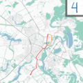
Sketch-marshrut4.png 800 × 800; 834 KB
-
Sketch-marshrut5.png 800 × 800; 836 KB
-
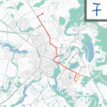
Sketch-marshrut7.png 800 × 800; 837 KB
-
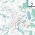
Sketch-marshrut8.png 800 × 800; 837 KB
-
Sketch-marshrut9.png 800 × 800; 781 KB
-
SurzhykUse en.png 731 × 499; 23 KB
-
Ukraine Blank Map (de facto borders).png 7,030 × 3,796; 406 KB
-
Ukraine former empires.png 757 × 805; 94 KB
-
Ukraine Historical Borders.svg 988 × 605; 1.06 MB
-
Ukraine irredentism.jpg 4,639 × 2,742; 419 KB
-
Ukraine map1.png 1,636 × 1,212; 766 KB
-
Ukraine-Rus (or Kievan Rus) map.jpg 540 × 443; 27 KB
-
Ukrayinski Etnokulturni Rehiony newp.png 6,440 × 4,327; 2.02 MB
-
Ігор Гайдук зустрівся з представниками Всесвітньої Продовольчої Програми ООН 6.jpg 3,670 × 2,447; 3.32 MB
-
Історичні.png 8,500 × 5,500; 5.92 MB
-
ВП карта ЛЖД.jpg 850 × 1,000; 333 KB
-
Житло2.png 2,466 × 1,749; 518 KB
-
Картосхема Дніпровсько-Донецький басейну на теренах України.webp 667 × 488; 449 KB
-
Мапа КНР.png 2,207 × 2,200; 1.44 MB
-
Нові райони з кольорами.png 565 × 456; 30 KB
-
Проект Павла Скоропадського.jpg 1,034 × 1,045; 105 KB
-
Райони.png 8,500 × 5,500; 1.16 MB
-
Хандусь.png 1,194 × 775; 327 KB
-
Ямницька сільська громада.jpg 2,448 × 2,448; 1.78 MB


.png/120px-Ostriv_Velykyi_Potomkin_(5_June_2023).png)


.jpg/120px-Secretary_Blinken_Meets_With_Ukrainian_Foreign_Minister_Kuleba_in_Kyiv_(51830997305).jpg)









.png/120px-Ukraine_Blank_Map_(de_facto_borders).png)


_map.jpg/120px-Ukraine-Rus_(or_Kievan_Rus)_map.jpg)


