Category:OpenStreetMap maps
Jump to navigation
Jump to search

Maps created using OpenStreetMap data. Place the template {{OpenStreetMap|name=placename}} on an image page to add it to this category.
Wikimedia category | |||||
| Upload media | |||||
| Instance of | |||||
|---|---|---|---|---|---|
| Category combines topics | |||||
| |||||
Subcategories
This category has the following 28 subcategories, out of 28 total.
G
- Geohack (13 F)
M
- MapOSMatic (25 F)
- Maps created with TileMill (41 F)
O
- OpenStreetMap Carto maps (85 F)
- OpenStreetMap maps of the world (34 F)
- OpenStreetMap town rendering (1 P, 39 F)
- OSM Mapper (2 F)
- OSM transparent overlays (12 F)
- OSM-Wikidata Map Framework (4 F)
P
- Panoramax (7 F)
S
W
- Wheelmap.org (9 F)
- Wikipedia-OSM-Gadget (31 F)
- WIWOSM (13 F)
- Www.historic.place (78 F)
Media in category "OpenStreetMap maps"
The following 200 files are in this category, out of 1,259 total.
(previous page) (next page)-
20160726 OSM-Bonamoussadi.png 840 × 630; 653 KB
-
20160727 OSM-Mons-be.png 845 × 612; 773 KB
-
20180522 OSM SR48 Veneto.jpg 1,145 × 774; 114 KB
-
Al-Sakhir Palace.png 857 × 785; 220 KB
-
Alto Douro Wine Region map.jpg 832 × 513; 103 KB
-
Andatza OSM 2018.png 840 × 676; 518 KB
-
Angouleme location map.svg 886 × 744; 5.66 MB
-
Arlington and Haller City.png 2,048 × 2,878; 672 KB
-
Arta Djibouti.jpg 691 × 355; 38 KB
-
Auckland CBD Map BW.png 1,258 × 856; 615 KB
-
Autostrada regionale Cispadana.jpg 1,207 × 454; 133 KB
-
Autovía del Cantábrico A-8.jpg 4,522 × 480; 356 KB
-
Avenida Gómez Laguna.png 504 × 526; 164 KB
-
Baldinger-Tor Detail.png 400 × 303; 75 KB
-
Baltieji Lakajai.png 970 × 611; 135 KB
-
BANCO edit shop.png 1,281 × 800; 324 KB
-
Bardo location maps.png 652 × 458; 133 KB
-
BarnaulTramSystem.png 1,067 × 1,055; 312 KB
-
Battle of Abidjan.png 858 × 642; 477 KB
-
Battle of Abidjan.svg 745 × 580; 2.71 MB
-
BelgradeMunicipalities.svg 1,425 × 1,829; 3.08 MB
-
Beneden-Merwede Location osm.png 1,031 × 361; 433 KB
-
Bennebroek osm.png 1,027 × 666; 361 KB
-
Bielawa location maps.png 586 × 535; 193 KB
-
BiesboschKaart.png 744 × 570; 614 KB
-
Big Creek Reservoir map.png 631 × 530; 38 KB
-
Binh Dinh Province Districts low.jpg 1,264 × 1,754; 181 KB
-
Binh Dinh Province Districts.png 2,528 × 3,507; 1.3 MB
-
BiyskTramSystem.png 1,373 × 793; 186 KB
-
Bludov mapa.png 420 × 527; 172 KB
-
Bosco Verticale Map.png 1,156 × 798; 1.18 MB
-
Boswachterij Groesbeek.jpg 1,357 × 847; 463 KB
-
Bouches-du-Rhône department location map.jpg 1,451 × 960; 194 KB
-
Bouches-du-Rhône department relief location map.jpg 1,451 × 960; 262 KB
-
Bouvet.png 595 × 367; 19 KB
-
Boyacá123municipios etiquetas.svg 1,488 × 1,052; 874 KB
-
Brabantse Biesbosch Kaart.png 854 × 638; 391 KB
-
Brandon, County Durham.svg 1,095 × 1,076; 964 KB
-
Btishim98.png 811 × 2,168; 830 KB
-
Burg Bonames Lageplan.png 1,500 × 1,500; 337 KB
-
Bwapi-export-funktionen.png 800 × 700; 677 KB
-
Caldwell Branch map.PNG 1,209 × 684; 440 KB
-
Canal Network at Utrecht osm.png 1,155 × 1,746; 596 KB
-
Carrers d'Olià.png 1,138 × 814; 69 KB
-
Carrière des Nerviens (alentours)-fr.svg 1,021 × 1,140; 2.27 MB
-
Carte ecomobilité de Vitré.JPG 848 × 525; 115 KB
-
Carte maffle.png 685 × 530; 137 KB
-
Carte-centre-ville-chambery.png 1,464 × 1,291; 1.07 MB
-
Cartograph screen.png 450 × 800; 715 KB
-
Central McDougall.svg 871 × 444; 2.63 MB
-
Cerro Chenque OpenStreetMap.png 719 × 407; 196 KB
-
Ceyhan river.jpg 624 × 462; 50 KB
-
Chain O'Lakes map with captions.png 1,028 × 1,168; 881 KB
-
Chain O'Lakes map.png 1,028 × 1,168; 861 KB
-
Charleville - Makumbi (1926 - 1955) (1231382).jpg 486 × 629; 29 KB
-
Chemiepark-Knapsack-OSM.png 687 × 664; 330 KB
-
CheryomushkiTramSystem.png 427 × 412; 79 KB
-
Chitipa-Ifumbo on road.jpg 815 × 704; 146 KB
-
Christchurch, New Zealand map.svg 948 × 779; 94 KB
-
Ciclovia alpe adria karte5.jpg 803 × 1,143; 285 KB
-
Coloring GPS Tracks According to Speed.png 712 × 960; 418 KB
-
Com-arribar-VP10-BCN-20110319.png 533 × 623; 217 KB
-
Comallo openstreetmap.png 471 × 470; 33 KB
-
Comuna de Santiago map.svg 597 × 571; 694 KB
-
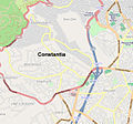
Constantia CT Map.jpg 595 × 553; 346 KB
-
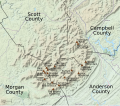
Crab Orchard Mountain Peaks.svg 962 × 845; 4.99 MB
-
CuidandoDoMeuBairro-anos.png 1,208 × 982; 849 KB
-
CuidandoDoMeuBairro-main.png 1,210 × 944; 532 KB
-
Công cụ OpenStreetMap tại Wikipedia tiếng Việt - Bắc Kinh.png 785 × 554; 153 KB
-
Dalby hage, tillfartsvägar.jpg 796 × 577; 46 KB
-
Darlington's Bridge approximate location.svg 1,004 × 895; 277 KB
-
Daugavpils (location map).png 798 × 872; 151 KB
-
Daugavpils (location map).svg 491 × 488; 707 KB
-
Deutsch Fahrradrout Györ.png 1,116 × 942; 1.65 MB
-
Divisão distrital de Júlio de Castilhos RS.png 3,507 × 2,480; 234 KB
-
Dolomitenradweg4.jpg 800 × 817; 164 KB
-
Dordolla Friuli Italy Openstreetmap 160129.jpg 437 × 523; 91 KB
-
Dordtsche Kil Location osm.png 798 × 570; 397 KB
-
Downtown Pensacola Map.png 871 × 586; 288 KB
-
Dubai location map.png 485 × 406; 121 KB
-
Dzanga-Sangha Complex.png 459 × 485; 13 KB
-
DzerzhinskiyTramSystem.png 845 × 413; 78 KB
-
Dzielnica Włochy location map.png 825 × 726; 247 KB
-
E-road E87 small.png 252 × 302; 17 KB
-
E68 route.svg 1,200 × 330; 66 KB
-
E751-overview-map.svg 738 × 687; 110 KB
-
Ecotec after.png 650 × 634; 58 KB
-
Ecotec Before.png 650 × 634; 1.58 MB
-
EkaterinburgTramSystem.png 1,161 × 1,353; 505 KB
-
El Sawy Culture wheel map 2.jpg 985 × 587; 197 KB
-
Elafónisos map.svg 2,831 × 2,119; 138 KB
-
Erle-openstreetmap.PNG 898 × 613; 47 KB
-
Europoort osm.png 1,345 × 678; 741 KB
-
F54 carte pistes cyclables Nancy Nov 2020.jpg 1,235 × 666; 1.27 MB
-
Flemington as viewed by OpenStreetMap.JPG 663 × 637; 63 KB
-
Flygfoto Göteborg 2013.png 830 × 814; 757 KB
-
Fulufjället National Park topographic map-fr.svg 2,274 × 3,938; 1.57 MB
-
Fundy National Park topographic map-fr.svg 1,043 × 1,076; 5.36 MB
-
FWS Nyköping 2010-2.jpg 2,680 × 3,108; 3.83 MB
-
Färnebofjärden National Park flood satellite map-fr.svg 3,511 × 4,693; 4.67 MB
-
Färnebofjärden National Park flooding comparison topographic map-fr.svg 3,511 × 4,693; 1.7 MB
-
Färnebofjärden National Park satellite map-fr.svg 1,772 × 2,368; 2.41 MB
-
Färnebofjärden National Park topographic flood map-fr.svg 3,511 × 4,693; 1.69 MB
-
Färnebofjärden National Park topographic map-fr.svg 3,511 × 4,693; 1.69 MB
-
Galle Fort.png 832 × 833; 139 KB
-
Gangneung OSM map.svg 514 × 476; 608 KB
-
Gayaza and Lake Nakivale.png 1,151 × 828; 156 KB
-
Gazi Karakolu.svg 430 × 225; 194 KB
-
Gemarkungsgrenzen Rodgau.png 461 × 545; 216 KB
-
Gemeinde Affing blank.svg 733 × 556; 997 KB
-
Gemeindekarte Affing.png 1,166 × 872; 174 KB
-
Kaart natuurgebied De Sijp.jpg 634 × 294; 74 KB
-
Geopedia on iPhone 5s.png 640 × 1,136; 217 KB
-
Gindelalm karte.png 1,212 × 745; 773 KB
-
Glasgow.png 1,280 × 955; 282 KB
-
Gols map osm.png 929 × 825; 317 KB
-
Grand-Central-NewYorkCity-USA-OpenStationMap-Screenshot.png 1,318 × 696; 225 KB
-
Grič Tunnel on OpenStreetMap.png 506 × 374; 102 KB
-
Grosser Nonnenwald Karte.svg 2,500 × 3,849; 897 KB
-
Grote ring tilburg.png 560 × 354; 375 KB
-
Große Wien Karte.png 894 × 832; 742 KB
-
Großglockner (Umgebungskarte).png 971 × 607; 685 KB
-
Gs relacje 06.png 1,162 × 561; 51 KB
-
Gênes centre historique.svg 1,128 × 1,023; 440 KB
-
Göksu River (map).jpg 788 × 612; 207 KB
-
Habitats de la carrière des Nerviens-fr.svg 624 × 452; 516 KB
-
HaifaCentrale EN.svg 1,160 × 651; 698 KB
-
HaifaCentrale-HE.svg 1,160 × 651; 925 KB
-
HaifaCentrale.svg 1,160 × 651; 884 KB
-
HaldeHoppenbruch OSMKarte.png 1,561 × 1,199; 730 KB
-
Hallandsastunneln.jpg 395 × 505; 16 KB
-
Haringvliet Location osm.png 898 × 662; 238 KB
-
Heatmap TAH 2 (3674759727).jpg 509 × 490; 286 KB
-
Heatmap TAH 3 (3674760067).jpg 509 × 490; 242 KB
-
High Five Interchange map.svg 881 × 583; 1.44 MB
-
Highways in Meridian, MS.png 736 × 552; 281 KB
-
Historical gallows field at Scheveningseweg, The Hague.jpg 1,200 × 1,424; 1.9 MB
-
Hoddle Grid OpenStreetMap.svg 2,818 × 2,175; 9.53 MB
-
Hollands Diep Location osm.png 731 × 412; 138 KB
-
Hollandse Biesbosch Kaart.png 854 × 638; 488 KB
-
Homel maps.png 786 × 848; 412 KB
-
Hostelling International Washington DC and environs.png 1,122 × 626; 310 KB
-
Houtman Abrolhos, Easter Group, Central, OSM.jpg 371 × 590; 11 KB
-
Hoxne hoard local context map.gif 254 × 238; 11 KB
-
Hressingarskálinn Map.png 871 × 541; 92 KB
-
Hyères topographic blank map.jpg 1,568 × 674; 59 KB
-
HÉV állomások.png 1,400 × 1,140; 741 KB
-
I190i294i90interchange.svg 2,288 × 1,124; 145 KB
-
IffleyVillageMap.png 504 × 454; 128 KB
-
IJsselmonde osm.png 1,356 × 926; 1.38 MB
-
InaccessibleIsland2021OSM.png 3,627 × 2,788; 995 KB
-
Interchange A2 A4.svg 1,200 × 1,200; 18 KB
-
Inylchek.png 1,294 × 654; 1.94 MB
-
Irmak–Karabük–Zonguldak.png 3,500 × 3,380; 868 KB
-
Isla de Flores Montevideo.png 1,006 × 755; 399 KB
-
Isla Maillen.jpg 967 × 491; 62 KB
-
Itämetro-Östmetron.kartta-karta.svg 691 × 336; 310 KB
-
IzhevskTramSystem.png 783 × 841; 192 KB
-
Jinchen Sub-district map.jpg 1,278 × 903; 715 KB
-
Jokeri-linja-Jokerlinjen.svg 1,420 × 710; 457 KB
-
Jumeirah Islands in Dubai.png 1,554 × 935; 1.26 MB
-
Juneau map.png 913 × 965; 166 KB
-
Jurong Regional Line - JRL (Choa Chu Kang West Station) JS2.png 920 × 516; 284 KB
-
Jyväskylä bus map display.JPG 4,608 × 3,072; 5.23 MB
-
Kaart Afgedamde Maas.png 1,085 × 713; 568 KB
-
Kaart Regte Heide.jpg 1,068 × 1,458; 423 KB
-
Kabylie topographic blank map-fr.png 959 × 480; 458 KB
-
Kabylie topographic map-fr-2.svg 847 × 423; 4.98 MB
-
Kabylie topographic map-ru.svg 848 × 425; 4.97 MB
-
Kamienna Góra location map.png 603 × 425; 177 KB
-
Kampong Ayer, Brunei from OpenStreetMap.png 612 × 385; 216 KB
-
Kanmaw Island.png 923 × 977; 129 KB
-
Karte Bahnstrecke KR-RY.svg 1,341 × 1,763; 4.69 MB
-
Karte Chiemgau.png 2,155 × 1,870; 1.33 MB
-
Karte der Amerikalinie (Bahnstrecke).png 4,790 × 1,400; 1.77 MB
-
Karte der Bahnstrecke Buchholz - Hannover.png 865 × 2,467; 956 KB
-
Karte der Bahnstrecke Buchholz - Wittenberge.png 3,400 × 914; 859 KB
-
Karte der Bahnstrecke Dannenberg - Salzwedel.png 693 × 740; 132 KB
-
Karte der Bahnstrecke Královec–Žacléř.jpg 1,881 × 928; 525 KB
-
Karte der Bahnstrecke Langwedel - Uelzen.png 2,131 × 461; 397 KB
-
Karte der Bahnstrecke Liberec–Kořenov.png 2,457 × 1,062; 2.04 MB
-
Karte der Bahnstrecke Plaue - Themar.png 1,599 × 2,146; 1.58 MB
-
Karte der Bahnstrecke Türkismühle–Kusel.png 1,998 × 983; 1.85 MB
-
Karte der Bahnstrecke Uelzen - Braunschweig.png 591 × 1,876; 406 KB
-
Karte der Bahnstrecke Uelzen - Dannenberg.png 1,050 × 562; 168 KB
-
Karte der Bahnstrecke Uelzen - Stendal.png 2,172 × 1,022; 747 KB
-
Karte der Bahnstrecke Wolgast–Heringsdorf–Ducherow.png 1,769 × 1,381; 638 KB
-
Karte der Friedbergbahn (Suhl - Schleusingen).png 972 × 788; 290 KB
-
Karte der Kleinbahn Rennsteig – Frauenwald.png 1,203 × 1,575; 447 KB
-
Karte der Südbahn in Österreich.jpg 2,275 × 3,590; 4.49 MB
-
Karte der Wasserstraßen in Potsdam.png 1,311 × 1,216; 530 KB
-
Karte des Bürgerparks und des Stadtwalds in Bremen.png 1,850 × 2,915; 1.18 MB
-
Karte des Datteln-Hamm-Kanals.png 2,672 × 906; 1.2 MB
-
Karte Fossilfundstellen der Santa-Cruz-Formation.jpg 2,034 × 1,140; 394 KB
-
Karte Heilbronn orig. Verlauf Nordbahn.png 1,009 × 824; 795 KB
-
Karte Mauke.svg 865 × 828; 175 KB
-
Karte vom Naturpark Niederlausitzer Heidelandschaft.png 2,010 × 1,410; 1,006 KB
-
Karte vom Weinbaugebiet Pfalz.png 1,214 × 2,076; 1.41 MB
-
Karte Waldheide OSM roh.png 1,663 × 2,374; 596 KB




-fr.svg/107px-Carrière_des_Nerviens_(alentours)-fr.svg.png)


_(1231382).jpg/93px-Charleville_-_Makumbi_(1926_-_1955)_(1231382).jpg)







.png/110px-Daugavpils_(location_map).png)
.svg/120px-Daugavpils_(location_map).svg.png)









.png/120px-Großglockner_(Umgebungskarte).png)


.jpg/120px-Göksu_River_(map).jpg)


.jpg/120px-Heatmap_TAH_2_(3674759727).jpg)
.jpg/120px-Heatmap_TAH_3_(3674760067).jpg)






_JS2.png/120px-Jurong_Regional_Line_-_JRL_(Choa_Chu_Kang_West_Station)_JS2.png)




.png/120px-Karte_der_Friedbergbahn_(Suhl_-_Schleusingen).png)


