Category:Screenshots of OpenStreetMap
Jump to navigation
Jump to search
Media in category "Screenshots of OpenStreetMap"
The following 108 files are in this category, out of 108 total.
-
2018 OSM banner FOSS4G-IT.png 357 × 625; 54 KB
-
2018-09 OpenStreetMap.de copyright banner.png 996 × 775; 516 KB
-
2020 7 17 Stöckter Hafen.jpg 797 × 538; 114 KB
-
2023-03-05 Objektkoordinaten in OSM 1.jpg 956 × 765; 40 KB
-
2023-03-05 Objektkoordinaten in OSM 2.jpg 956 × 765; 40 KB
-
2023-03-05 Objektkoordinaten in OSM 3.jpg 956 × 765; 67 KB
-
2023-03-05 Objektkoordinaten in OSM 4.jpg 956 × 765; 53 KB
-
2023-03-05 Objektkoordinaten in OSM 5.jpg 956 × 765; 57 KB
-
Ajout des lieux-dits de Marie-Galante sur Openstreetmap (34406384906).jpg 1,320 × 743; 444 KB
-
Alfa Karina Arrué en Dingboche.png 756 × 582; 854 KB
-
Centre of Salvador de Bahia after Mapping Party.jpeg 838 × 463; 132 KB
-
Centre of Salvador de Bahia before Mapping Party.jpeg 838 × 483; 107 KB
-
Creacion de notas en OpenStreetMap - Añadir nota.png 498 × 194; 131 KB
-
Creacion de notas en OpenStreetMap - Descripción de la nota.png 676 × 656; 32 KB
-
Creacion de notas en OpenStreetMap - Nota creada.png 996 × 830; 490 KB
-
Creacion de notas en OpenStreetMap - Pantalla de nueva nota.png 1,566 × 938; 1.43 MB
-
Creacion de notas en OpenStreetMap - Pantalla principal.png 1,566 × 1,128; 2.22 MB
-
Creacion de notas en OpenStreetMap - Ubicación chincheta.png 518 × 356; 281 KB
-
Easy map - Set a custom zoom level for the map, once it's opened.png 493 × 420; 180 KB
-
Eselsweg.png 1,206 × 802; 672 KB
-
Exportación OpenStreetMap.png 1,366 × 791; 445 KB
-
Flightgear 2018.3 - Madrid, Spain at dawn with OSM2City output.jpg 1,080 × 607; 81 KB
-
GPXSee screenshot.png 819 × 1,090; 886 KB
-
Gökçeada OpenStreetMap map.png 1,220 × 636; 107 KB
-
HKKR - OSM Map - SCRSHOT - 20191029 0926.png 1,219 × 886; 3.1 MB
-
Innsbruck in FlightGear 2020.x with OSM2City Output based on Open Street Map data 01.jpg 1,920 × 1,080; 805 KB
-
Innsbruck in FlightGear 2020.x with OSM2City Output based on Open Street Map data 02.jpg 1,920 × 1,080; 779 KB
-
Jardin Niel (OSM 2023-06-17).jpg 1,768 × 1,362; 365 KB
-
Jouko reittiopas.jpg 1,440 × 2,600; 521 KB
-
Jouko route guide.jpg 1,437 × 2,714; 492 KB
-
Karta, Wiki Loves Earth 2021.png 1,251 × 843; 1.21 MB
-
Koordinaten Monrestraße 69 Kalkar.png 992 × 732; 205 KB
-
Map of Bowmanville, Ontario - 2023-02-15.png 1,175 × 1,175; 1.21 MB
-
Mapa, Dolnoslezské vojvodství západ.png 1,207 × 634; 695 KB
-
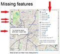
Mapframe compare features missing.jpg 913 × 820; 393 KB
-
Marble Screenshot OpenStreetMap.png 1,280 × 986; 1.21 MB
-
McNabs Island.png 669 × 568; 383 KB
-
MultiMaps Leaflet frame.png 583 × 396; 264 KB
-
Nota anónima en OpenStreetMap.png 1,366 × 791; 543 KB
-
Nota de Open Street Map.png 1,366 × 768; 170 KB
-
Nota de OpenStreetMap.png 1,366 × 768; 494 KB
-
NV439 map large.png 986 × 882; 246 KB
-
NV439 map small.png 826 × 780; 65 KB
-
NZ NP Pa.png 1,827 × 900; 830 KB
-
NZ NP ParihamorePa.png 1,828 × 872; 436 KB
-
NZ NP PuketarataPa.png 1,828 × 872; 440 KB
-
OpenStreetMap edit animation.gif 1,066 × 716; 465 KB
-
OpenStreetMap Login.png 1,357 × 640; 68 KB
-
OpenStreetMap Tampere.jpg 1,920 × 860; 442 KB
-
OpenStreetMap Карта города Учалы 2009-08-30.png 1,077 × 813; 56 KB
-
OpenStreetMap Карта города Учалы.png 1,541 × 1,023; 1.14 MB
-
OSM 1.png 520 × 309; 103 KB
-
OSM 2.png 520 × 309; 165 KB
-
OSM 5.png 137 × 187; 12 KB
-
OSM 6.png 613 × 329; 182 KB
-
OSM 7.png 520 × 306; 46 KB
-
OSM 9.png 374 × 314; 157 KB
-
OSM Mappa di Livo.png 1,172 × 1,832; 1.24 MB
-
Osm-carto compare 2017.jpg 1,875 × 967; 1.09 MB
-
Osm-screenshot1.png 450 × 336; 120 KB
-
Osm-screenshot2.png 450 × 337; 150 KB
-
Osm-screenshot3.png 450 × 334; 119 KB
-
Osm-transport-super-relation.png 639 × 392; 149 KB
-
OSM3.png 249 × 340; 84 KB
-
OSM4.png 520 × 310; 127 KB
-
Outline of Depreciation Lands.png 946 × 594; 572 KB
-
PlanetenwegDerGrünenNachbarschaft.png 429 × 976; 404 KB
-
Ponts de Rangiport situation.png 1,398 × 804; 265 KB
-
Presque-quadripoint.png 1,691 × 828; 5.36 MB
-
Puerto Antonio Morán OpenStreetMap.png 633 × 420; 29 KB
-
Périmètre peste porcine africaine Belgique-2018.png 1,082 × 648; 747 KB
-
Road relation on OpenStreetMap.png 697 × 548; 392 KB
-
RoBrasov Centre map.png 742 × 765; 374 KB
-
RoBrasov-map01.png 863 × 729; 303 KB
-
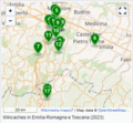
Screenshot delle mappe delle Wikicaches - Meta 2.png 358 × 331; 142 KB
-
Screenshot delle mappe delle Wikicaches - Meta.png 870 × 366; 223 KB
-
Screenshot nenafocené.png 1,080 × 2,160; 650 KB
-
Screenshot openstreetmap.png 1,440 × 900; 760 KB
-
Screenshot WMA and OSM maps.png 947 × 280; 144 KB
-
Seitengroesse PDF 7.png 1,280 × 1,024; 1.26 MB
-
Spaceport LaunchComplex LaunchPad.png 930 × 746; 314 KB
-
Tagging for the Renderer - Bruin Bowl commercial.png 1,115 × 931; 238 KB
-
Traffic signs JOSM style.jpg 1,187 × 1,015; 745 KB
-
Trelew Screenshot OpenStreetMap.png 256 × 256; 15 KB
-
Turn restriction mapping in iD (animated gif).gif 780 × 390; 398 KB
-
Turn restriction mapping in iD.png 796 × 482; 142 KB
-
Turn restriction mapping in Vespucci (animated gif).gif 640 × 360; 5.93 MB
-
VerNotas-2.png 182 × 104; 34 KB
-
VerNotas-3.png 580 × 872; 564 KB
-
VerNotas-4.png 606 × 436; 201 KB
-
VerNotas-5.png 1,540 × 912; 1.79 MB
-
Wikiraduno Bologna marzo 2023 - Screenshot Certosa di Bologna - dopo.jpg 1,280 × 800; 207 KB
-
Wikiraduno Bologna marzo 2023 - Screenshot Certosa di Bologna - Overpass Turbo abc1.png 2,560 × 1,315; 1.33 MB
-
Wikiraduno Bologna marzo 2023 - Screenshot Certosa di Bologna - Overpass Turbo abc2.png 2,560 × 1,315; 1.34 MB
-
Wikiraduno Bologna marzo 2023 - Screenshot Certosa di Bologna - Overpass Turbo abc3.png 2,560 × 1,287; 1.93 MB
-
Wikiraduno Bologna marzo 2023 - Screenshot Certosa di Bologna - prima.jpg 1,280 × 800; 160 KB
-
Wikiraduno Bologna marzo 2023 - video Certosa di Bologna - Open Burial Map abc1.webm 19 s, 2,560 × 1,400; 7.13 MB
-
Wikiraduno Bologna marzo 2023 - video Certosa di Bologna - Open Burial Map abc2.webm 16 s, 2,560 × 1,400; 2.57 MB
-
World Bank Recommended Address Infrastucture.svg 1,682 × 966; 478 KB
-
WP-OSM-Gadget-Karte-bedienen.jpg 1,466 × 465; 249 KB
-
Α23 connection with Balkan Map.png 778 × 818; 494 KB
-
Маршрут ЦПКиО – Подольское море 2022 (cropped).png 1,014 × 502; 656 KB
-
Маршрут ЦПКиО – Подольское море 2022.png 1,454 × 652; 1.1 MB


.jpg/120px-Ajout_des_lieux-dits_de_Marie-Galante_sur_Openstreetmap_(34406384906).jpg)


.jpg/120px-Jardin_Niel_(OSM_2023-06-17).jpg)


.gif/120px-Turn_restriction_mapping_in_iD_(animated_gif).gif)

.gif/120px-Turn_restriction_mapping_in_Vespucci_(animated_gif).gif)


_abc1.png/120px-Wikiraduno_Bologna_marzo_2023_-_Screenshot_Certosa_di_Bologna_-_OpenStreetMap_-_nodo_Tomba_Borghi-Mamo_(10763329050)_abc1.png)


.png/120px-Маршрут_ЦПКиО_–_Подольское_море_2022_(cropped).png)
